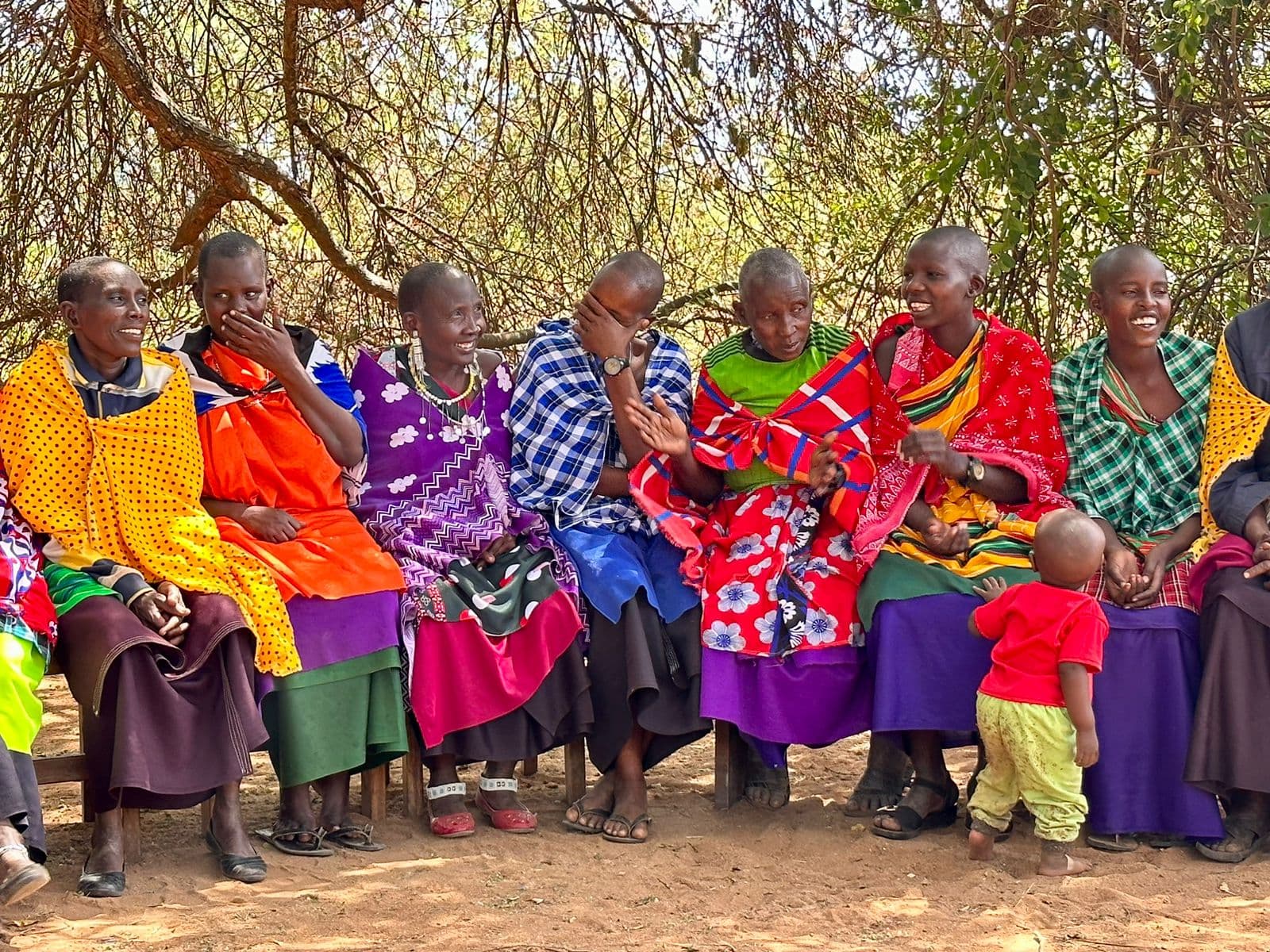
Northern Tanzania
Working through ICI in a globally significant ecological system of rangelands extending south and east of the greater Serengeti-Ngorongoro that suppor...
Defending the collective will of Indigenous Peoples
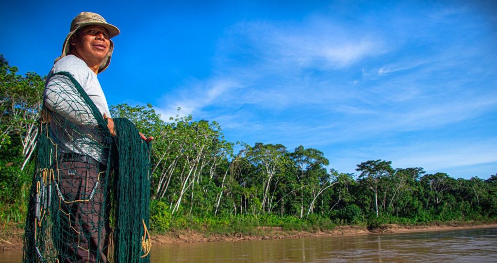
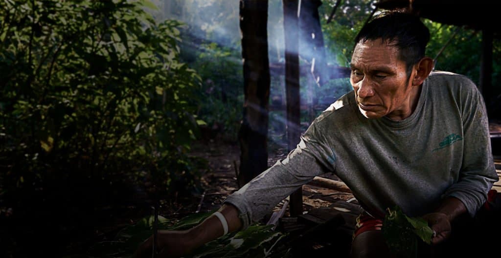
In the Madre de Dios River basin in Peru, an ancestral tropical forest territory home to several Indigenous communities, the Native Federation of Madre de Dios River and tributaries (FENAMAD) advocates to legitimately represent and defend the collective will of all Indigenous Peoples of Madre de Dios, including those living in isolation and initial contact.
Under this initiative ICI aims to improve the management of 3,748,946 hectares in Peru, engaging 5,505 direct project stakeholders.
Strengthen territorial monitoring and surveillance and early warning systems at the community level with the support of satellite and other technologies
Consolidate the protection of IPACI under the principle of “no contact” in the area of the Manu National Park and Madre de Dios
Strengthen the capacities and skills of the people to improve governance, planning and territorial management (life plans, territorial zoning, statutes, among others)
Enhance capacities and skills related to financial administration, project development and management, and fundraising
Strengthen and revalue the cultural identity of the peoples and their relationship with their history and ancestral territories. Self-management processes of Indigenous peoples better organized as active partners in defining policies for the conservation of their territories with natural protected areas
Revalue, document, promote research on traditional knowledge and practices to ensure food sovereignty, climate change mitigation, biodiversity loss
Promote processes of bi-national exchange between the peoples and organizations that are members of the proposal for Inclusive Conservation, aimed at agreeing on criteria, consolidating alliances, transferring experiences and knowledge
Strengthen the capacities of Indigenous leaders and their participation in international conservation and human rights spaces and networks
Strengthen strategies for the protection of defenders and women
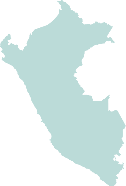
Peru
7,497,911
5,505
Global Biodiversity Hotspots and High Biodiversity Wilderness Areas:
Tropical Andes
Biosphere Reserves:
Manu Biosphere Reserve
World Heritage Sites
Manu
Protected Areas/ Wildlife Management Areas/etc.:
Manu National Park; Amarakaeri Communal Reserve; Tambopata National Reserve; Bahuaja Sonene National Park; Alto Purús National Park
Key Biodiversity Areas:
Manu
Parque Nacional Purus y Bahuaja Sonene; Reserva Nacional Tambopat; Reserva Comunal Amarakaer; Reserva Territorial de Madre de Dios para pueblos indigenas en aislamiento
34%
10
This subproject geography is in the Peruvian portion of the Southwest Amazon. It is part of the Amazon biome and is located in the large basins of the Madre de Dios, Beni and Mamoré rivers. It comprises three large ecological areas: the sub-Andean mountain ranges, the foothills of the Andean Cordillera, and the extensive Amazon alluvial plain. The altitudinal gradient ranges from 250 meters to 4,000 meters above sea level, with precipitation ranges between 1,500 and 6,000 and mm/year, which give it a high degree of ecological fragility. This produces a mosaic of extraordinarily rich tropical rainwater ecosystems. The protected areas in this subproject area (Manu, Amarakaeri, Bahuaja-Sonene and Tambopata) are part of the Vilcabamba-Amboró Conservation Corridor, and are recognized as among the most biologically rich hotspots on the planet. The area contains about 70% of the biodiversity of Peru, including a high number of endemic species of flora and fauna. It is extraordinarily important for the maintenance of ecosystem services of enormous local, regional and global value, including provision of natural resources (timber, NTFPs wildlife, etc.), carbon sequestration, and watershed regulation.
The subproject area includes 4 Indigenous groups, including groups in isolation and initial contact. On the Peruvian side of the Madre de Dios River basin, there are weaknesses and limitations to the legal recognition of the right to territory of Indigenous peoples – since in the absence of specific figures in accordance with international standards – they have been categorized as Native Communities, protected areas, and others, which do not recognize their integrity or guarantee ownership. This context allows for the granting of rights to third parties, limiting the exercise of self-determination and self-management, and generating conflicts between communities and external actors. The subproject area includes part of the territory of the Mashco Piro people in isolation, and contributes to the protection of a cross-border area in Peru and Brazil of more than 8 million hectares, known as the PIACI Pano Arawak Territorial Corridor. Conservation models focused on rights, identity and territorial claims have gained momentum as a result of the formation of four ethnic organizations, representing four peoples: the Ese Eja Nation (2013), the Harakbut Nation (2016), the Matsigenka People of Manu National Park (2017) and the Yine Nation (2018). These new organizational forms emerged, driven by, and in articulation with, existing multi-ethnic organizations. FENAMAD and its intermediate organizations assert the ethnic identity of their members and seek to consolidate and formalize themselves as interlocutors with the Peruvian State in larger territories that include highly biodiverse protected areas (Manu, Amarakaeri, Bahuaja-Sonene, Tambopata), and to actively participate in their conservation and governance. Thus, presents a dynamic context for organizational trajectories and evolving political and normative frameworks in which Indigenous territorial rights are defined.
Working through ICI in a globally significant ecological system of rangelands extending south and east of the greater Serengeti-Ngorongoro that suppor...
The Bose Vanua o Lau in Fiji and the House of Ariki in the Cook Islands work together through ICI to advance Indigenous Peoples’ goals for sustain...
Alliance Nationale d'Appui et de Promotion des Aires et territoires conservés par les Peuples Autochtones et Communautés locales en République Dém...