Ru K’ux Abya Yala
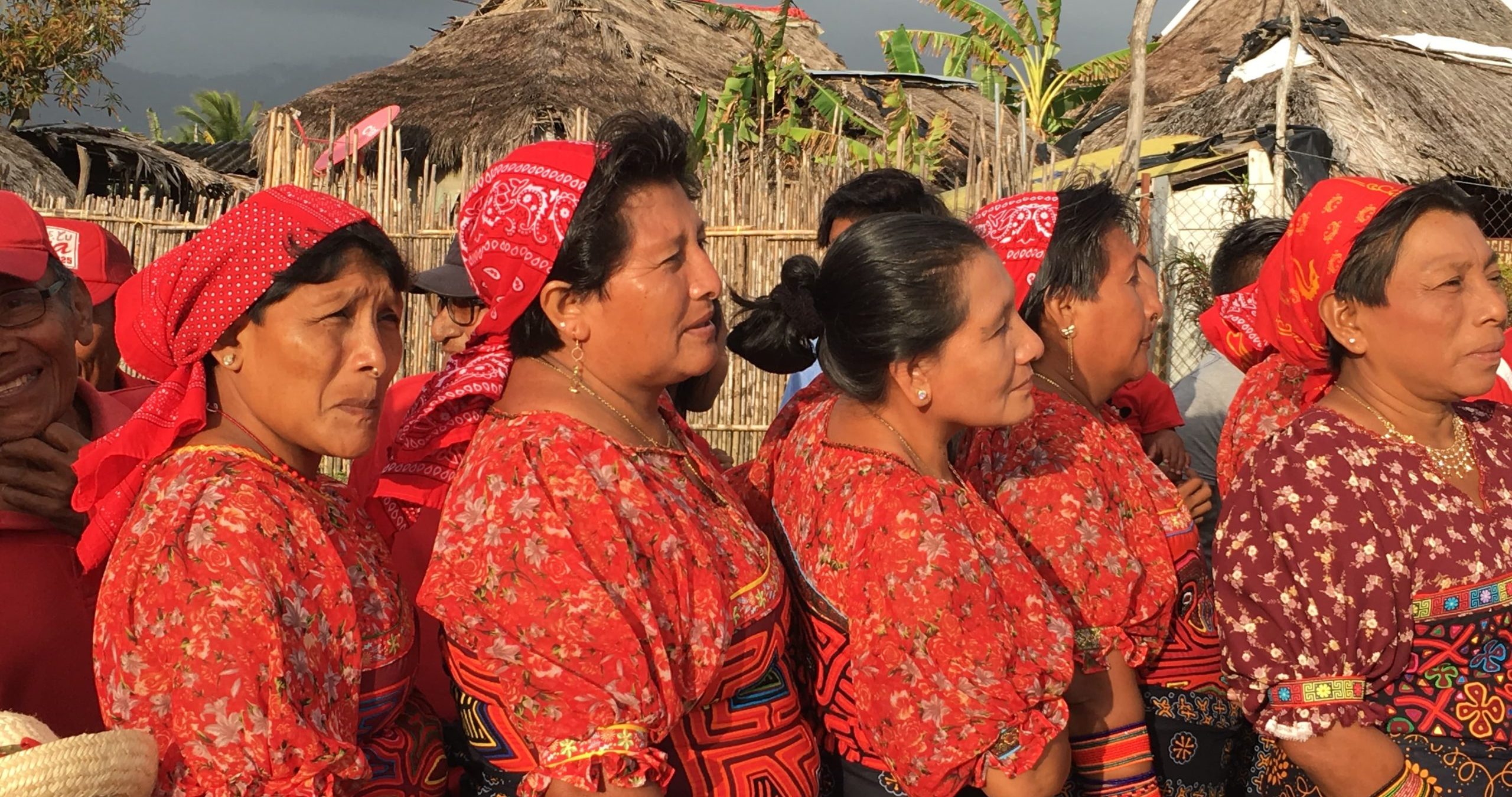
In Guatemala and Panama, a consortium of Indigenous organizations led by Sotz’il is working to foster the Indigenous use, management, and conservati...
Supporting el buen vivir as a model of Indigenous life.

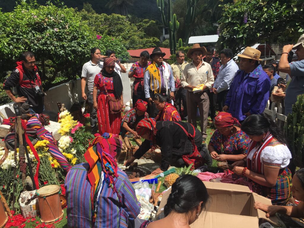
In Mesoamerica, a consortium of Indigenous organizations led by Sotz’il is working to foster the Indigenous use, management, and conservation of natural resources in the regions of the Ru K’ux Abya Yala and to promote the Utz K’aslemal (el buen vivir – living in harmony) as a model of Indigenous life. Working in an area composed by three biocultural territories (Kaqchikel and K’iche’ Volcanic Chain, Lachuá and Caribbean Rainforests of Guatemala, and Guna of Panama) and spanning more than 56,000 hectares of land stretching from Guatemala to Panama, through ICI Sotz’il plans to strengthen Indigenous institutional systems, promote intergenerational exchanges and gender equality, bolster Indigenous-led natural and cultural resource management in the context of the COVID-19 recovery, and promote Indigenous green economy for the benefit of all.
Under this initiative, ICI aims to bring 427,317 hectares under improved management, engaging 3,820 project stakeholders.
Strengthen territorial councils, elders, traditional authorities, spiritual guides, women, youth
Facilitate intergenerational exchanges
Promote knowledge about Indigenous institutions, establish research centers
Strengthen management capacities and knowledge about collective rights and conflict resolution
Systematize traditional Indigenous norms and compilation of national and international instruments on natural resources
Develop protocols of good traditional practices of resource management
Create conditions for indigenous participation and generation of strategic alliances on the issues of natural resources and COVID-19
Produce case studies of Indigenous governance for collective management of natural resources
Rehabilitate territories and/or ecosystems post COVID-19
Strengthen the capacities of Indigenous women and youth in practices for the use, management, and conservation of natural resources and culture
Strengthen indigenous territorial and natural resource management based on traditional knowledge and practices, such as: community management plans, Indigenous territorial management and mapping, protocols for good practices in use, management and conservation, action plan for the management of marine and coastal resources, and case studies, strategies and plans for adaptation and mitigation of climate change and environmental degradation
Enhance chains of productive enterprises and their agroforestry, handicraft, non-timber forest products, and tourism services production units
Increase market access and marketing of products from Indigenous enterprises, with added value, that are friendly to the natural and cultural environment of the post-COVID-19 priority ecoregions
Pursue certification of natural and cultural Indigenous products
Pursue forestry incentive mechanisms and compensation payments for the conservation of natural and cultural resources
Enhance institutional support framework for strengthening technical and administrative conditions, equipment and human resource management
GuatemalaPanama
854,604
2,517,773
Global Biodiversity Hotspots and High Biodiversity Wilderness Areas:
Mesoamerica
Key Biodiversity Areas:
Guna Yala (Panama)
Ramsar sites:
Guatemala: Laguna Lachuá
Protected Areas/ Wildlife Management Areas/etc.:
Laguna Lachuá (Guatemala)
Important Bird Areas:
Maya –; Lachuá – Ik’bolay; Cadena Volcánica Kaqchikel;
Guatemalan Caribbean Slope (Guatemala)
Narganá Wildlands Area; Guna Yala (Panama)
Guatemala 16%Panama 22%
Guatemala 25Panama 0
The Central American region has 8% of the world’s biological diversity, distributed in 206 ecosystems, 33 ecoregions, 20 life zones and 12% of the coasts of Latin America and the Caribbean, including 567,000 ha of mangroves and 1,600 km of coral reefs. The subproject has a regional focus for an integrated intervention in Mesoamerica, which will work in Indigenous territories in two countries – Guatemala and Panama – in landscapes that form important ecoregions in Central America, including the Mesoamerican Biological Corridor, the Ecoregion of Montane Forests, the Association of Pine-Oak Forests of Central America and the Mesoamerican Reef System. These ecosystems are interconnected for the purpose of conserving ecological processes, facilitating genetic exchange, evolution, migration, and repopulation of species and are consistent with Indigenous Maya, Garifuna, and Guna territories. The Kaqchikel Volcanic Chain and K’iche’ are part of the broadleaf, cloud, pine and oak forests and grasslands that are part of the Zunil, Atitlán and Balam Juyu Biocultural Corridor, which are rich in endemic faunal biodiversity. Lachuá, Q’eqchi territory, is an ecoregion of broadleaf forests and a Ramsar site, of 100,000 hectares. It links to the Blue Mountains of Chiapas Mexico, is the second model forest of Guatemala and is part of the Ibero-American model forest network. It represents more than 50% of Guatemala’s biodiversity, the majority of which are endangered species. The Río Dulce region has biological connectivity and is home to species of regional endemic importance. The Guna Yala region covers 751,300 hectares of continental and marine areas. It is a high priority ecoregion for the conservation of global diversity and functions as a biocultural corridor in the Isthmus, with about 70% forest coverage, 30 species of reptiles, 440 species of birds, and other tropical forest species. It also has coral reefs, mangrove ecosystems, extensive networks of reefs and shallow water seagrass beds of the continental platform, of importance in the biographical coast of the Northwest Atlantic and the central Caribbean bioregion.
The areas in this subproject are under different modalities of use, management and conservation of natural resources. In the case of the Mayan (Kaqchikel, K’iche’, Q’eqchi’) and Garifuna peoples they are under a system of collective Indigenous management and shared management. The Guna case involves management by an Indigenous system led by regional congresses. Central America has 948 terrestrial and marine protected areas, with an extension of 245,857 km2, of which approximately 39% is located in Indigenous territories, such as the Mayan forest, parks in municipal regions, Guna Yala biosphere reserve, resulting in a shared management and governance between protected area systems and indigenous territories. Indigenous governance in each region is based on their own traditional forms of organization and governance, local committees, ancestral brotherhoods, organization of spiritual guides, Indigenous community, territorial councils, development councils or county congresses. Economic activities include agroforestry, annual and permanent rotating and intercropping agricultural crops, collection of low-impact non-timber products, and traditional fishing systems (near reef and mangrove areas specifically in the case of the Guna people).
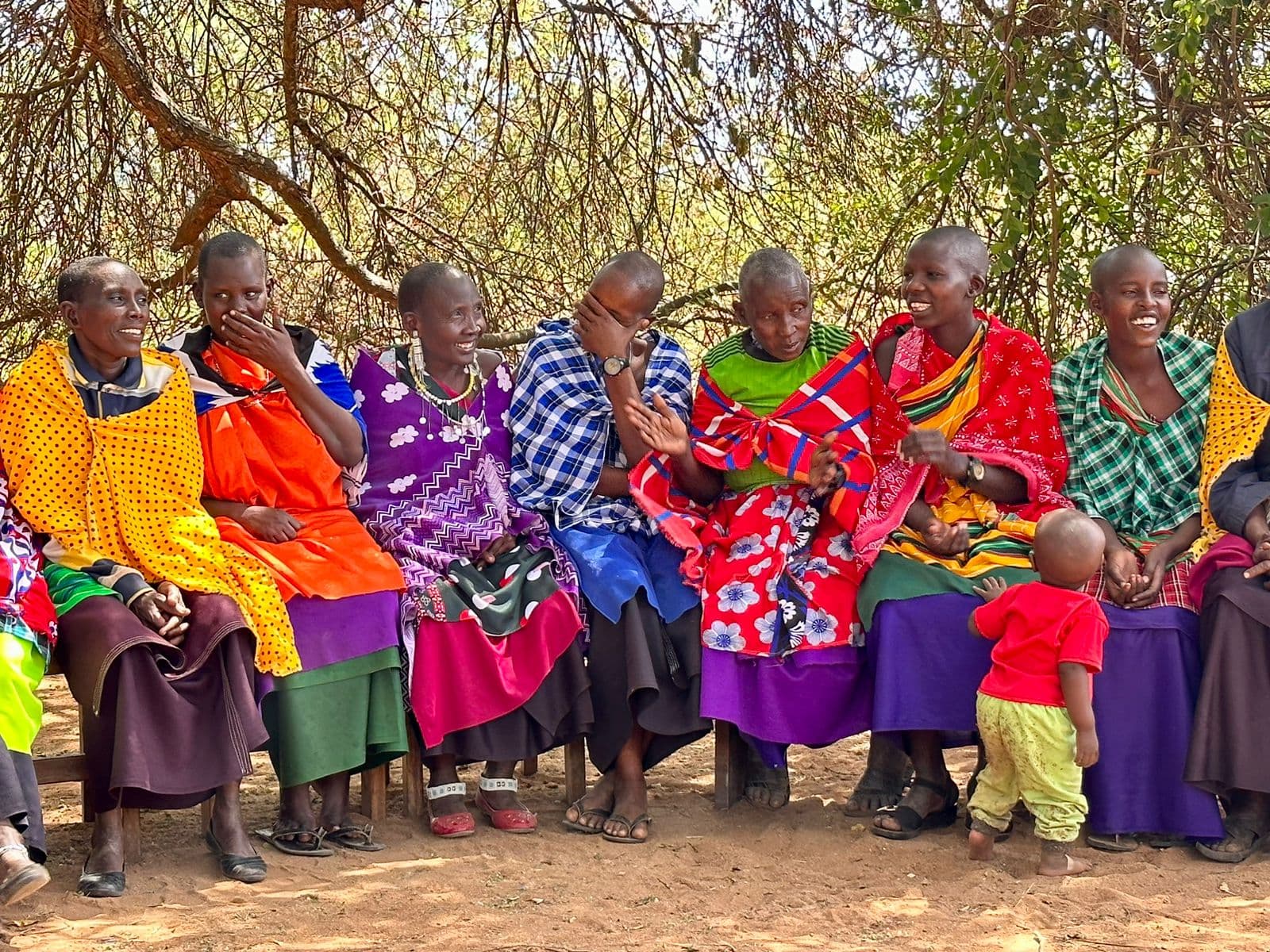
In Guatemala and Panama, a consortium of Indigenous organizations led by Sotz’il is working to foster the Indigenous use, management, and conservati...
Working through ICI in a globally significant ecological system of rangelands extending south and east of the greater Serengeti-Ngorongoro that suppor...
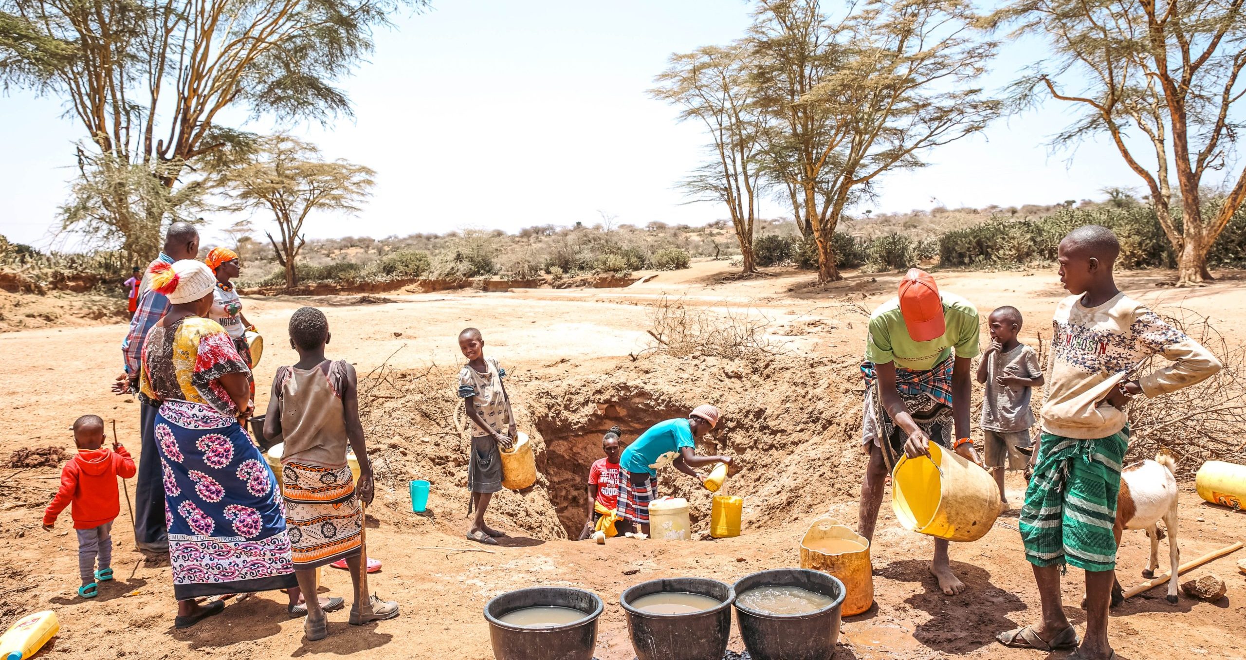
The Indigenous Movement for Peace Advancement and Conflict Transformation (IMPACT) in the Kenyan rangelands supports Indigenous Peoples in securing re...